 |
|
|
 |
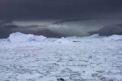 |
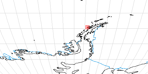
Taken in Lallemand Fjord at around 67 10 south and 66 40 west April 1st around 9 am ship time, as we churned our way into this area. On the ice were seals and storm petrels and skuas were winging through the air. This area is amazing. We are here collecting some sediment traps that were put out last year. Last year, a month earlier in the season, this was all open water and the ice shelf was a straight smooth surface. This season it is all cusps where huge sections have broken out. The ice shelf does not show in the photo but some of the big bergs do. The mountains in the background are on the Loubert Coast ( I think). Not exactly sure which direction this view is taken as we were turning the boat in circles trying to clear the ice so we could recover the sediment traps. |
We have spent the morning mapping the bottom of Lallemand Fjord. This was done with the SeaBeam multi beam profiler which constructs a real time contour map of the ocean floor. Post processing can create a pseudo 3D shaded relief map from the data. The contour map shows glacially scoured channels in the bottom that have then been filled in with sediment.
The shape of the ice front is constantly changing. Last year it was a straight smooth face. This year it is cusp like with many missing areas. The whole shelf has retreated during the past ten years. We know this because on our navigation charts which were printed in 1988, three of our stations plot on the ice itself.
The weather seems to be causing us some problems today. After a calm morning the clouds came down, snow started and the wind increased to 70 knots. This built the seas to 10-12 foot wave heights according to the officers on the bridge. In the open sea they said the wind would have built the waves to 40 feet.
The wind and waves caused some problems with the sea floor mapping as did some grounded and slow moving icebergs we had to detour around.
The mapping is now complete and we are headed north out of the fjord back to where we took our first core. Once on station we will attempt to take an additional core, and so some sampleing of the water column with the CTD.
I forgot to mention where CTD comes from in the last post. C is for conductivity which is governed by the salinity, T is temperature, and D is depth.
Along with these instruments and the rosette of bottles there is also a transmissivity meter to document the clarity of the water.
Currently the weather does not look good for this work. The winds have dropped to around 45 knots and the ceiling is lifting a little. It is still snowing and waves are running around 10 feet. Currently the deck is secured. That means that no one is allowed outside on the deck the ship.
Weather was too bad to do anything at our planned station so we have begun to travel NE towards Palmer Station.
EVENING REPORT
The weather has calmed as we moved northeast and we are currently taking a Kasten core. The first attempt failed, collecting very little sediment. Now it's headed back down again. Water depth here is 910 meters. Depending on the core we may attempt a second kind of core and drag a dredge on the bottom to collect some biologic samples.
The weather this afternoon made for some interesting sights on the ship. You quickly get use to moving in the downhill direction and then bracing as the ship rolls and pitches in the opposite direction. This can cause for some very accelerated movement down the halls and staircases take on a whole new sensation. It's sixty stairs from the lab level of the ship to the bridge. Thirty feet above the bridge is the ice tower. Climbing the ladders to the ice tower are a challange anyway and with any kind of a roll it is difficult. No one was climbing to the ice tower today. The most striking thing I saw was the water in the coffee maker. There is a standard drip coffee maker in the lab and the water was coming into the pot at about a 35 degree angle.
Second attempt with the Kasten core is coming on deck now so have to run.
Cheers to everyone,
Dave Tewskbury
Almost forgot. During the rough weather earlier today we had a large number of yellow, "hang on" rolls and when the ships position and waves corresponded just right we even had a couple of pink zone "jeepers" rolls.
|
|
 |