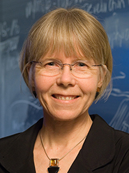
Professor of Geosciences Barbara Tewksbury presented “Using High Resolution Imagery in Google Earth for Research in Remote Regions” at the annual meeting of the American Association for the Advancement of Science (AAAS). The meeting was held Feb. 12-16 in San Jose, Calif.
The presentation was part of a session on “Geospatial Innovations in Imaging Information Intelligently.” She discussed her research projects in the Western Desert of Egypt and the use of Google Earth to browse large areas of the remote area in order to find interesting research problems. Tewksbury said that “Google Earth provides a virtually cost-free strategy for collecting enough data to make a credible proposal for research funding” and that its use “was critical for discovery of the largely unstudied bedrock structures” she is currently studying.
She went on to discuss ways Google Earth affects how research is conducted with collaborators in several locations in the United States and Egypt. Tewksbury said that taking field notes in Google Earth allows the researchers in the field to find critical target areas easily.
Posted February 18, 2015
