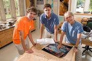
Most people use the program Google Earth to zoom in on their houses, fly through the Grand Canyon, or maybe to see if their neighbors have pools. But from the lab of Barbara Tewksbury, Tucker Keren ’13 and Steve Kemp ‘11 are using the program to analyze some fascinating linear features in the southwest corner of the Egyptian desert several hundred kilometers west of Aswan. Tewksbury is Upson Chair for Public Discourse and Professor of Geosciences.
On a geologic map of Egypt, the bedrock in this portion of the Western Desert is shown as sandstone that is about 100 million years old and covered in places by young windblown sand. The map shows long linear structures that are mostly oriented east-west and north-south, but the map does not indicate what the features are other than calling them “lineaments.”
These lineaments are obvious in Google Earth at an eye elevation of about a kilometer or so. At even lower eye elevations, many more smaller structures are also evident, and these smaller structures, which have never been mapped before, are the key to determining what the lineaments are and, ultimately, to developing a model for the larger structures.
The team is mapping both the major and minor linear features using the imagery in Google Earth and is also looking at related features all the way down to a microscopic scale using thin sections made from samples that Tewksbury collected in Egypt last winter in an area farther to the east near Aswan. She, along with Keren and Kemp, has interpreted these features are as a series of faults and fault-related features that formed when billion-year-old faults were reactivated in the past 50 million years and caused the young, overlying sandstone to crackdevelop new faults as well. They will try to determine just why that happened, and their work will provide important information that will help constrain models for the tectonic evolution of Egypt in the past several tens of millions of years.
“The ridges that we are mapping have low relief, if any. People could drive by these features in the desert without even noticing them,” Kemp pointed out. This may be why there has never been any extensive research on these features. “That’s why Google Earth is so helpful in our research,” Keren added. “It allows us to look at the region on a much broader scale and actually see these structures.” Because other satellite imagery of the region lacks the resolution that the team needs, they are relying primarily on the high-resolution satellite imagery of Google Earth. As part of their research, Keren and Kemp are studying the formation of similar features in other parts of the world and attempting to find correlations.
“A lot of people don’t realize the potential of Google Earth in studying geology,” Keren explained. ”Barb uses the software heavily while teaching because Google Earth allows her students to see structures of all kinds from around the world without ever leaving the classroom.” “That’s the amazing part of our research,” Kemp added. “We’re mapping these features in Egypt while sitting in Clinton, New York.”
Keren is a graduate of Middlebury Union High School in Middlebury, Vt.; Kemp graduated from the Deerfield Academy in Deerfield, Mass.
Posted August 24, 2010
